My apologies for the long gap between posts, life has been a bit busy.
I recently began a new position in Vietnam, on Cat Ba Island to be specific. My first impressions are that this is a damp and precipitous landscape. I have not seen the sun since I arrived in Vietnam on March 4th. For Cat Ba Island this means a riotous profusion of greenery tempered by the steep terrain and lack of soil.

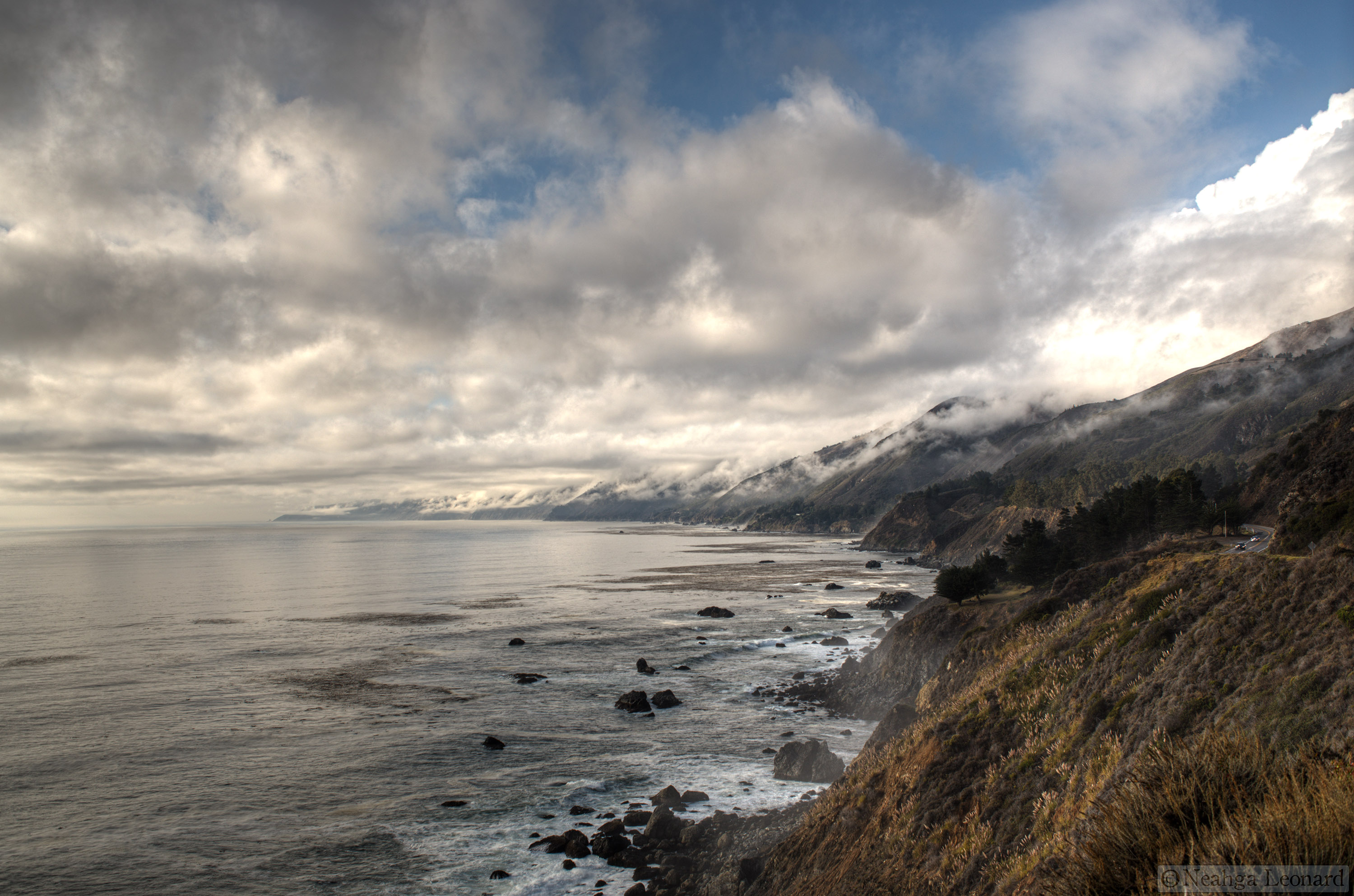
Where the northern end of the road terminates
This is a land where Ymir’s bones lie close to the surface, broken and weathered, their calcium leaking back into the waters from which these precipitous cliffs rise. The geology is the first thing that strikes you here. The cliffs have been weathered by millions of years of rain, the ever-so-slightly acid rainwater eating into the ancient limestone creating a mature karst landscape. Like bones, coral, and seashells, limestone is primarily made up of calcium carbonate, which in other forms makes marble and dolomite. This is probably one of the reasons this is a place where snail diversity is immense, ranging from tiny frilled creatures more akin to limpets to giant land snails, many of which are still unknown to science. Snails need lots of calcium to make their shells.

Unknown frilly terrestrial snail

Land snail shells collected around the office – and a wasp nest
The banded limestone found here is a relic of abundant diatom (a type of plankton) skeletons laid down five hundred million yeas ago and subjected to the vagaries of time. Limestone, while soft to the chisel and hammer, is a remarkably durable stone at the macro-scale, one of the reasons climbers like it, but at a chemical level it is easily weathered. We are often told that water has a pH of 7, that is it neutral. Natural rainwater, we then assume, should also have a pH of 7, but it is closer to 5.6 due to the dissolution of carbon dioxide into the water making carbonic acid. A pH of 5.6 is about as acidic as a cucumber or an onion for comparison. Of course, other environmental factors can reduce this tremendously, leading to extremely acidic rain. Rain falling on the limestone erodes small channels in the rock that look like thumbprints in wet clay.

Rainwater erosion on limestone
Eventually these concentrate water flow, carving small holes in the stone reducing it to a swiss-cheese like structure with an extremely jagged and sharp exposed surface. These little caves connect into larger caves. In these protected, damp environments bacteria grow, exuding waste products and creating hydrogen sulfide that mixes with the water and makes a weak sulfuric acid, increasing the chemical weathering. This cycle persists, eventually leading to enormous caves.
The airflow in these caves evaporates the mineral rich water tricking through the now porous stone and the calcium carbonate re-solidifies into stalagmites, stalactites, soda straws, and any number of strangely beautiful and complex cave structures.
Caves often form in weak portions of the stone and, eventually, gravity takes its toll and the weakened rocks collapse leaving behind steep spires and fields of slowly eroding boulders.

Limestone spire in the north end of Cat Ba Island
Cat Ba and Ha Long Bay are examples of a drowned karst landscape, a mature karst landscape that has been flooded by rising waters. What little soil does form is washed down into the many bays, coves, and channels of the region, leaving little for plants to sink roots into. In the shallow waters of the bays mangroves find nutrients, in abundance. Here mangroves are near the northern margin of their range, their numbers restricted and the trees short, making low dense forests.

Gray mangroves (Avicennia marina) on the south western side of the island
As in many places, the mangroves are in trouble here, often cut down to make shrimp farms. This leads to reduction in local fisheries, increased erosion, and lack of protection from storm surges and tsunamis. The local government is taking steps to protect what remains and to, potentially, restore some of the previous mangrove forests. In the rich mud of the mangrove regions there are numerous animals, among them one of my favorites, mudskippers, amphibious fish that hop about in the mud protecting their little territories.

Mudskipper amongst mangrove roots
On the cliffs however there are few nutrients and plants grow in what cracks and declivities they can find. As per many islands there are a number of endemic species, here one of the most commonly seen ones is the Ha Long Cycad (Cycas tropophylla), an ancient type of gymnosperm that looks like a cross between a fern and a palm tree.

Ha Long Cycad (Cycas tropophylla), endemic to a 400 square km area, globally rare, locally abundant
The season here is shifting into spring and some of the trees have begun blooming, among them the hoa gạo or Cotton Tree (Bombax ceiba), so named for the kapok-like fibers that are found in the seed pod.

Hoa Gạo (Bombax ceiba), Cotton Tree in English. The Vietnamese name translates to “Rice Flower”
I still have not seen the little primates I came here to work with, they are few in number and they clamber about on the vertical cliffs like, well, monkeys.
Soon though.