A Long Flight over the Canadian Shield

Recently I flew from Istanbul to Los Angeles, following a great-circle route over Ukraine, Norway, Greenland, and Northern Canada.  As I always do when flying, I got a window seat and spent most of the flight peering out the window, developing a crick in my neck that took several days to loosen.

Much of the European and Greenland portions of the flight were shrouded in clouds, leaving me watching a vast expanse of what looked like glowing cotton.  Occasionally patches would open in the clouds and I would catch a brief glimpse of the land or sea below, and a look at one of the most talked about ecosystems on our planet.

Ice floes on the Arctic Ocean

Ice floes on the Arctic Ocean

The northern polar region, the Arctic.  This is a vast region centered on the bath-tub-like basin of the Arctic Ocean.  Discussing directions in the polar regions is tricky, for in the arctic, pretty much every direction that is not north is south, thus geography is a better indication of location than compass points.  On one side the entryway to the Arctic Ocean is narrow, shallow, and flows over the ancient land-bridge that once connected North America and Asia.  On the other side warm water flows up the Atlantic Ocean to the east of Greenland, keeping Europe warm and pushing the ice away from the Norwegian coast.  This is the primary point of water-flow into the Arctic Ocean.

To the west of Greenland a network of channels in the Queen Elizabeth Islands lets water slowly filter out of the basin, trickling back into the Atlantic via the southern opening of Baffin Bay.  Amongst the islands fierce currents keep polynyas open in the ice, providing open water for eider ducks and other sea-birds that over-winter in the Arctic.  Generally the whales will leave the Arctic during winter, but sometimes they become trapped and these polynyas provide the only places they can find air to breath.

Since we have been keeping records the sea ice extent has been getting smaller and smaller.  Records of sea ice extent and other cold-weather data can be found free of charge at the National Snow and Ice Data Center.

Several years ago, as part of a graduate project on Ringed Seals I looked at the changes in ice extent for the month of April over the last 30 years.  The photo of the broken sea ice above was taken on the eastern side of Greenland, a place where the sea-ice is extremely variable.

1981 - 2010 April Sea Ice Extent:  Darker colors indicate a greater number of years of coverage, lighter colors, fewer years of coverage

1981 – 2010 April Sea Ice Extent: Darker colors indicate a greater number of years of coverage, lighter colors, fewer years of coverage – green indicates areas outside of ice-cover that are shallow enough to provide foraging areas for Ringed Seals

The little flashes of ice I got to see through the grubby Turkish Airlines plane window were tantalizing, but they were only teases.  The interesting views were to come later, as we passed over the Canadian Shield.

Flying over over the Melville Peninsula, looking east to Foxe Basin... I think

Flying over over the Melville Peninsula, looking east to Foxe Basin… I think

Here, over the Canadian Shield, a 3 million square mile (8 million square kilometer) expanse of heavily weathered, exposed bedrock billions of years old the signs of past glaciation are evident.  Not merely evident, the fossil tracks of vast continental glaciers shout their presence to the sky.  Fortunately, I happened to be in the sky, with a camera at the ready.

There is a common misconception about glaciers.  People have heard that glaciers carve channels into the bedrock and grind down mountains.  This is only partially true.  Ice is not very hard, by itself ice can carve channels into rock the hardness of chalk or talc, but not into tough rocks like granite, the rock much of the Canadian Shield is composed of.  Ice levers out whole boulders and picks up loose material where it lies.  These become embedded in the ice and these are what does the scouring and carving.  The ice provides the weight and movement, much like a person provides the force when sanding or filing a piece of wood or metal, but it is the sandpaper or the file that does the actual cutting.

Ice, when it comes in glacier quantities, is an elasto-plastic material.  The upper surfaces are brittle and crack, making crevasses and seracs, but the deeper ice, down below the 50 meter mark, is more akin to a slow, cold silly-putty than to the brittle thing we put in lemonade.  When the ice is kilometers deep it oozes, flowing like spilled molasses over the land, dragging with it the entrained materials, grinding down high points, smoothing jagged surfaces, and hollowing out U-shaped valleys, leaving behind a stream-lined surface replete with the marks of its passage.

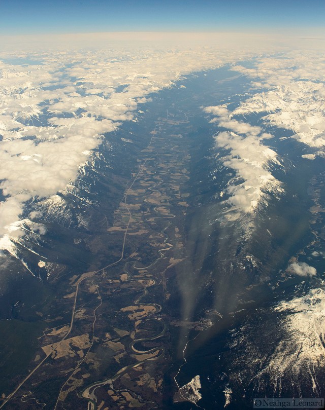
Rocky Mountain Trench in the Canadian Rockies - a classic glacially carved valley

Rocky Mountain Trench in the Canadian Rockies – a classic glacially carved valley

In both photos above the U-shaped valleys are clear.  These valleys come in all sizes, some more impressive than others.  The Rocky Mountain Trench in British Columbia is one of the more impressive ones, as is the Gilkey Trench in South-East Alaska.

The Gilkey Trench, the speck in the foreground is a person and each of the ripples in the bottom is 10 meters high

The Gilkey Trench, the speck in the foreground is a person and each of the ripples in the bottom is 10 meters high

These valleys are often found in mountains, places where the glaciers ground out material between the peaks, but left the high places alone.

Billions of years ago the Canadian Shield used to be home to vast mountains, now they are all gone, only their roots remain.  Erosion from various sources and repeated glaciations have scoured the Canadian Shield over and over again, grinding even the great mountains into low mounds, leaving traces that are best seen from the air.

Exposed bedrock showing fault-lines and ancient mountain cores

Exposed bedrock showing fault-lines and ancient mountain cores

The long, straight lines are old fault lines, places where geologic stresses broke the rock and let it slide against itself.  Here the rock is already damaged and the glaciers excavated long channels that look like canals from the air.  The distorted oval in the lower middle of the photo is where a bubble of rock forced its way up in the distant past, creating a mountain or large hill.  Now it has been ground flat and shows up in the surface pattern, much like cut wood shows the pattern of knots and grain despite being smooth to the touch.

Over much of the Canadian Shield soils are shallow to non-existent.  Even south of the tree-line vast areas are sparsely vegetated for lack of soil.  Roads are difficult to make as the land is smooth only at large scale and it is riddled with lakes and rivers.

In the winter the smoothest parts of the Canadian Shield are the lakes themselves and they are where temporary roads are made.

A road on the frozen lakes to the north of Yellowknife

A road on the frozen lakes to the north of Yellowknife

The last major glaciation was relatively recent, only about 20,000 years ago and the land is still recovering from the effects.  The whole Canadian Shield is undergoing isostatic rebound; with the weight of the up to 3 miles (almost 5 kilometers) of ice coming off the Earth’s crust it is now rising, seeking a new equilibrium as it floats on the liquid rock mantle deep beneath the surface.  Rivers and lakes are draining, the courses sometimes shifting as the land rises, carving out new pathways.  Water, like the ice it came from, does not do the work of carving the rock, it is the sediment it carries, but the Canadian Shield is made of hard stuff and it takes time to carve new channels in this durable granite.

Meandering rivers in glacial sediment

Meandering rivers in glacial sediment

Further south, the land is still flat, but has been overlain by a layer of sediment, left behind as the glaciers retreated.  Here rivers carve into the land more easily, looping back and forth and pinching off sections of themselves.  These oxbow lakes and the irregular rocky ones to the north are home to untold numbers of mosquitoes and other insects with aquatic life-phases.  These insects, when they emerge, lure birds from as far away as the southern hemisphere, and the mosquitoes become the bane of any humans wandering in the vastness of northern Canada during the warm season.  These insects, both adult and larval provide feed for numerous fish, making this an excellent place for fishing.  The first time my family and I drove to Alaska much of our food was from fish we caught each evening after only a few minutes with a line in the water.

The glaciers that covered the Canadian Shield were continental in scale.  There are only a few places where vast sheets of ice like that remain, but many places (for now) where small alpine glaciers are present, and even more places where signs of past glaciation are common.

One of the most famous of the post-glacial relics is Half Dome in the Sierra Nevada mountains of California.

Half Dome

Half Dome

The last interesting views I had out the window of my plane were of Half Dome, or Tis-sa-ack in the local native language.  This sheer rock-face is a batholith, a granite upwelling often making the core of a mountain.  Despite its appearance, Half Dome was not split in half, it seems to have formed more or less in the shape it has now.  Glaciers have smoothed and rounded the upper surface and carved out the characteristic U-shaped valley below though.

Glaciers have had a far larger impact on the world than most people realize.  Humans reached Australia some 60,000 years ago, able to walk over-land all the way to where Bali is now, needing boats only for a short stretch from Bali to Lubok.  Fifteen thousand years ago people walked from Siberia to Alaska over a broad grassy plain when the sea level was some 300 feet (91 meters) lower than today as a result of the water locked up in the ice.

When Greenland and Antarctica melt (which they will eventually do with or without our presence, the only difference is when it happens) sea level will rise by some 200 feet (67 meters) above present day levels.  At the moment there is a lot of talk of halting climate change via geo-engineering projects.  This is talk that completely and painfully misses the point.

The climate is a dynamic system, one that experiences wide changes over long periods of time, with the changes sometimes happening rapidly.  Yes, we desperately need to stop messing with the climate by releasing fossil CO2, methane, CFCs, and all the other greenhouse gasses we pump into the atmosphere with such abandon.  We are pushing the natural changes hard, forcing them to be of greater magnitude and to happen faster than they would otherwise.  We need to stop this, but what we do not need to and should not do is compound our mistakes by dumping iron into the oceans, pumping sulfur into the upper atmosphere, or place orbiting mirrors in space to deflect sunlight in a misguided attempt to keep the climate the way it was during the early 1900s.

We are driven by our economic system to keep things in some idealized stasis based on the time when we built our current infrastructure.  We may want things to stay static, but the earth is dynamic and fluid.  In our short-sighted, profit driven efforts to “save” our political and economic systems we will destroy the very thing that those systems and our societies are based on.

Seeing the earth from new perspectives and thinking about what we see tells us about the world is important.  We are on a cusp, we are standing on the edge of our metaphorical Half Dome.  We can tumble off the steep edge with disastrous consequences, or we can ease our way back down the slightly less steep slope, and once more enjoy the rich valley floor below.

Pontianak to Sukadana: through the mangroves at high speed

It has been a while since I’ve written a new post.  Quite a bit has happened in the last few weeks, the key bit being that the position in Borneo has fallen apart on me unexpectedly shortly after arriving in Indonesia.

Despite the unexpected disappointment there was a lot to see and experience.  I last left off in Pontianak, a rough and tumble Indonesian city in West Kalimatan, a hardy workman’s city perched on the borders of one of the largest rivers in Borneo.  The name, Pontianak, refers to a specific type of vampire, a woman who died in childbirth, a somewhat strange thing to name a city after.

Boats and buildings line the riverside in Pontianak

Boats and buildings line the riverside in Pontianak

To get from Pontianak to Sukadana one may either take a round-about bus that runs over poorly maintained roads and may not make it during the rainy season, or a boat that races through broad channels in the mangrove swamp.  The slow boat takes more than a day and the speedboat takes between 5 and 6 hours, more if either of the two massive outboard engines are damaged by the numerous floating logs in the water or fouled by vegetation, old fishing nets, or garbage.

Speedboat returning to Pontianak from Sukadana

Speedboat returning to Pontianak from Sukadana

I had been expecting the boat to head out into the ocean and run down the coast.  I was pleasantly surprised that the route ran along the interior channels of the Kapuas River delta  instead.

Inland route from Pontianak to Sukadana.  Roughly 130-140 miles along the winding channels through the mangrove forest

Inland route from Pontianak to Sukadana. Roughly 130-140 miles along the winding channels through the mangrove forest

Mangroves are one of the most mysterious and interesting ecosystems to me, perhaps because I have spent so little time in them and because there are so few intact mangrove forests left in the world.  In terms of carbon sequestration mangroves are one of the most effective ecosystems for carbon storage.  Mangroves are the nursery for many species of fish and crustaceans, and protect coastal areas from storm surges and tsunamis.

The center for diversity of mangroves is in South East Asia where there are some 40 or so tree species from a variety of families that all have adopted the “mangrove” lifestyle.  Trees falling into the general category of mangroves share a number of features despite coming from different families; some form of air-breathing apparatus on the roots (stilts, knees, aerial roots, root spikes that lift above the mud, etc), high tolerance to salt, and floating fruits/seeds.

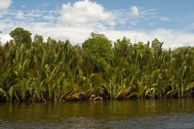
One of the more interesting plants in the mangrove forest is the Nipa Palm (Nypa fruticans).

Nipa Palms (Nypa fruticans) growing along the banks of the river delta

Nipa Palms (Nypa fruticans) growing along the banks of the river delta

This palm is unusual in several ways.  It often grows in areas where the trunk is completely submerged for long periods, making me wonder how it establishes itself in the first place.  This in and of itself is only mildly remarkable, what is truly odd is that the trunk is horizontal, growing underground, parallel to the surface, with all the greenery visible comprised of individual fronds acting as mini-trees growing from a single stalk.  In some ways the growth habit of this palm is more like that of a fern than a palm.

The fruits form in a large round mass, a little bigger than a basketball, divided into fist-sized floating seeds that break off and float away, sometimes germinating while still afloat.  The flower stalks are rich in sugar and this is one of the palms used to make palm sugar, a laborious process akin to making maple sugar, but limited to collecting sap from the flower stalks rather than tapping the tree.  Some studies indicate that this palm has a promising potential for biofuel production, but the process of cultivating or collecting enough to make this feasible would spell ecological devastation for immense regions of sensitive and already threatened habitat.

Mangrove forests are one of the most imperiled and under appreciated ecosystems in the world.  They are limited to tropical and near tropical regions.

Mangrove forest distribution from Charter Science

Many of the great tropical fisheries of the world owe their existence to mangrove forests; they provide nursery grounds for many aquatic species.  When mangrove forests are cleared to make room for development or for the shrimp farms that feed the developed nation’s voracious consumption of shrimp and prawns, these fish nurseries wither away, taking with them the tropical fisheries hundreds of millions of people rely on for their primary source of dietary protein.

Mangrove forests are found in low-lying, flat areas, areas subject to immense tidal run-ups, storm surges, and, in earthquake prone regions, areas where tsunamis can travel great distances inland.  The presence of mangroves acts as a buffer to these great movements of water, protecting both inland environments and human settlements.

In Southeast Asia the mangrove forests themselves provide a number of immediate resources for local people, including food, building supplies, medicines, and protected navigable waterways.

Local fellow collecting vegetation from the mangrove forest

Local fellow collecting vegetation from the mangrove forest

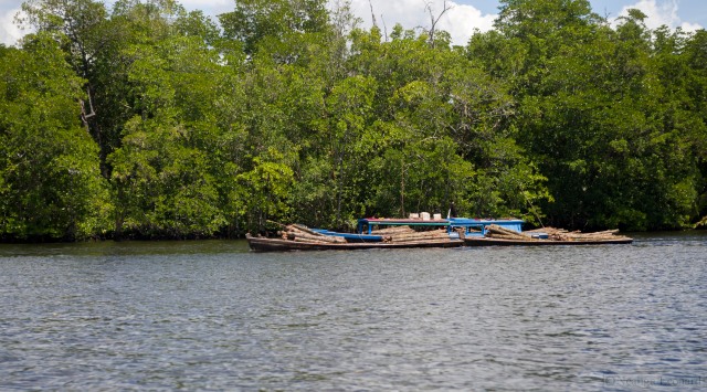
As in all areas people must make a living.  For some the only option is land clearing, whether for agriculture or timber.  In the Indonesian mangrove forests land is cleared for rice agriculture, aquaculture, and logging, primarily illegal.  Logging in this area is an enormous problem.  Large rafts of logs are often seen moored on the banks of the rivers and small-scale loggers carry short logs to local mills.

A small two person logging operation bringing palm logs home

A small two person logging operation bringing palm logs home

A larger logging operation bringing intermediate sized hardwood logs into the mill

A larger logging operation bringing intermediate sized hardwood logs into the mill

People fishing from a large raft of hardwood logs floated down from the interior forests

People fishing from a large raft of hardwood logs floated down from the interior forests

Nearly all the current logging in Indonesia is illegal.  The legal logging concessions have been cleared, in many cases converted to palm oil agriculture.  New land is legally cleared for palm oil, but current regulations prohibit the felled wood from being sold, thus this wood is often destroyed, resulting in an increased spread of illegal logging.

It is a cycle difficult to break.

In these areas dry land is a rare commodity and whole villages rest on stilts rising over the rivers and soggy ground.  Boats and motorcycles are the primary methods of transport, motorcycles being driven over narrow plank walkways with a casualness that makes the uninitiated cringe and wonder how many motorcycles lie in the mud at the bottom of the river.

Midday conversation on a stilt-village

Midday conversation on a stilt-village

The trip from Pontianak to Sukadana took a little more than 5 hours, an exhilarating 5 hours spent zipping through wide channels amongst one of the more interesting and briefly glimpsed ecosystems it has been my privilege to view first-hand.  I desperately want to go back to a diverse mangrove forest and spend months at a time clambering about, exploring and learning how it functions, but that will now have to wait until some undefined time in the future.

For this job in Indonesia I sold many of my things, put the rest in storage, spent a lot of money I would not have otherwise spent, and tossed my life in the blender with the assurance that the next step on my career path was well and firmly in hand.  Instead of an interesting and tasty life-shake emerging from the blender, the blender was casually and abruptly knocked off the counter, leaving my plans and work spread across the metaphorical floor in a sticky mess from which I am now attempting to salvage what I can.

Back to the job hunt, back to evaluating my life choices, back to laughing at the impracticality of my dreams.

Despite all, I had an opportunity few ever have and was able to see things most never even think about.  For that I am grateful.

Make the jump, take the risk.  If you make that leap you don’t know where you will land, but if you don’t nothing interesting will ever happen.

From Madrid to Kuching: new places, new sights, & oil palm plantations

I am nearly at my final destination. The little town of Sukadana in West Kalimantan (Indonesian Borneo) is only two more hops away, either a flight or bus ride, followed by a speedboat ride down the west coast of Borneo, a ride that passes through mangrove swamps and over muddy sea water.

At the moment I am in the city of Kuching (Cat City), in Sarawak, Malaysia. The Indonesian border is to the south and east, not far way, hidden by mountains and clouds. The province takes its name from the slow moving Sarawak river that runs through Kuching. As you might imagine, this part of the world is heavily boat centered.

River boat on the Sarawak in Kuching, Malyasia

River boat on the Sarawak in Kuching, Malyasia

The trip from Madrid to Kuching was an extension of the now ludicrous collection of hiccups, trials, and frustrations that have ridden on my coat-tails ever since I was nearly prevented from boarding the plane from Los Angeles to Madrid. Fortunately, these obstructions have only added spice to an unexpectedly fantastic voyage so far, full of delightful surprises, wonderful people, excellent food, and meat for a rich assortment of unbelievable stories.

I took Qatar Airways from Madrid, paying more in baggage fees than for my ticket (moving over-seas has even more unexpected expenses than regular moves do), caught the sunset from 35,000 feet over North Africa, a glowing pink/purple-amber layer of clouds that swiftly fell into gray, then black, and changed planes in the Doha airport. The flight path dodged and jinked in order to stay out of, let’s say “difficult”, airspace.

Qatar Airways flight path from Madrid to Doha

Qatar Airways flight path from Madrid to Doha

From Doha to Kuala Limpur, through immigration, then on Malaysian Air to Kuching.

One of my first views of Malaysia was of the vast oil palm plantations surrounding the Kuala Limpur airport.

Oil palm plantations are increasingly wide-spread through South East Asia

Oil palm plantations are increasingly wide-spread through South East Asia

The world appetite for palm oil is vast and ever growing. China and India use it for cooking, the US and Europe use it in shampoos, hand lotions, and face creams. All over the world is is added to foods, often called “coconut oil”, an act of creative labeling.

Enormous regions of diverse tropical forests are logged, razed to the ground, and replanted in monoculture stands of oil palms, stands that reach to the horizon in many areas. As one might imagine, the once great biodiversity of these areas drops precipitously.

Processing oil from the oil palms is labor intensive, requiring machinery that locals cannot afford and the process is only effective at a large scale. Thus, any money that is made from the oil palm industry remains in the hands of the investors and wealthy, with a miniscule portion of it dripping down to the people whose homes and land have been taken and transformed.

This is one of the great conservation concerns for the well being of both the people and biodiversity of South East Asia.

The plane lifted swiftly from Kuala Limpur, hiding the oil palm plantations under a dense layer of clouds that thinned once over the waters of the South China Sea. Several hours later I had my first sight of Borneo, my new home.

Mt Santubong, a small coastal mountain in Sarawak

Mt Santubong, a small coastal mountain in Sarawak

Just near the small mountain of Santubong, lies a town, not unlike the town that will be my new home.

The small town of Kampung Buntal in Sarawak at the base of Mt Santubong

The small town of Kampung Buntal in Sarawak at the base of Mt Santubong

I avidly peered out the window of the plane, in that awkward combination of a hunch and twist that you are forced into to see out of the tiny, smudged plane windows.

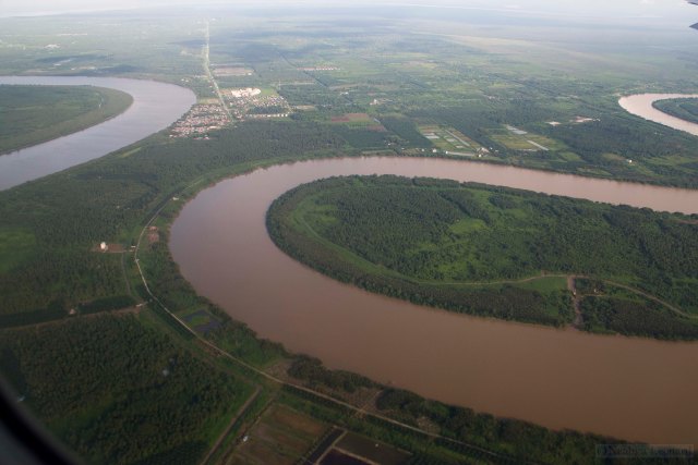
The rivers fascinated me. This part of the world receives an astounding amount of rain and even short rivers are wide with tremendous volumes of flow. Enormous amounts of sediment are carried by the waters, turning the sea around much of Borneo the color of hot chocolate. Some of the rivers originate in the flat areas and are nearly back from tannins released by decomposing vegetation. Each of these rivers leaves a swirling mark where it enters the ocean, and all twist and meander on their way to the sea.

Deep meanders as the rivers approach the sea

Deep meanders as the rivers approach the sea

Kuching is the capital of Sarawak, the southernmost province of Malaysian Borneo. It is a low, wet city with rainfall approaching 4.5 meters a year (depending on what source you read). This makes it one of the wettest cities on the planet, this morning and last night the thunder was frequent, shaking the buildings, and the rain violent in its path to the ground.

The riverfront has a nice park with shade trees and wide walk-ways. The humidity and heat lends itself to a rich collection of plants, of which ferns are well represented. Most of the river-front trees have climbing ferns creeping up them, some trees are completely covered by them.

Climbing ferns covering a small tree on the Kuching waterfront

Climbing ferns covering a small tree on the Kuching waterfront

Ornamental stands of Lipstick Palm (Cyrtostachys renda) add color to the walkways.

Lipstick Palms (Cyrtostachys renda) are planted in small stands

Lipstick Palms (Cyrtostachys renda) are planted in small stands

Bronze river dragons guard the banks of the Sarawak.

River dragon

River dragon

And Chinese temples have their own collection of guardians as well.

Chinese dragon guarding a Buddhist temple

Chinese dragon guarding a Buddhist temple

The internet connection at my hotel is growing erratic, so I will pause here and continue with another entry later.

I will be in Kuching for several more days, then, if all goes well and there are no other complications, on to Indonesia for both work and language school.


Brown Pelicans: today’s Pterosaurs

I am a big fan of Pelicans. They may be my favorite birds, though claiming anything to be a favorite is a little silly. I like all pelicans, but it is the Brown Pelican (Pelecanus occidentalis) and its cousin the Peruvian Pelican (Pelecanus thagus) that are at the top of my pelican list.

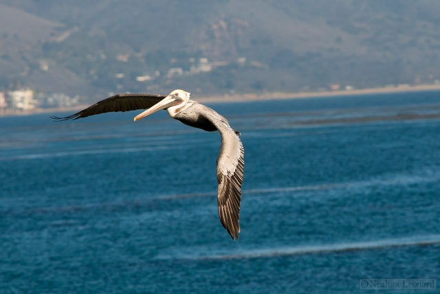
Brown Pelican (Pelecanus occidentalis) banking away from a landing at Point Dume, in Malibu

Brown Pelican (Pelecanus occidentalis) banking away from a landing at Point Dume, in Malibu

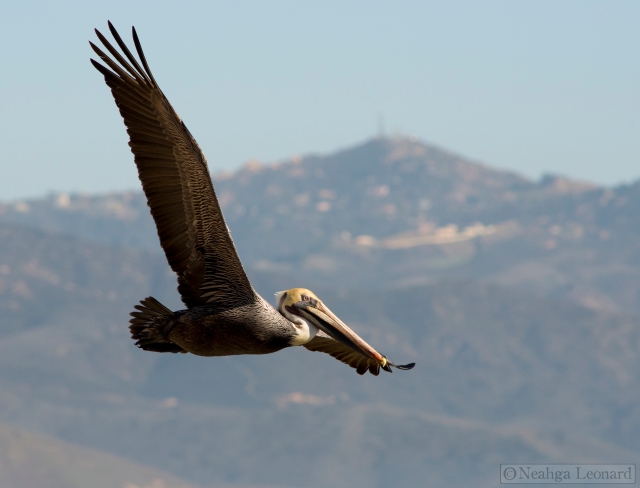
The Brown Pelican is the smallest of the 8 species of pelican in the world. Small is a relative term when it comes to pelicans, the Brown Pelican weighs up to 12 pounds (5.4kg) and has a wingspan up to a little more than 8 feet (2.4 meters). It and the Peruvian Pelican, which is nearly twice the size of the Brown Pelican, have a hunting strategy that differs from all other pelicans and one that is great fun to watch.

Pelicans are extremely successful apex predators. Their primary hunting tool, their beaks, have remained relatively unchanged for 30 million years as evidenced by a remarkably intact fossil from southern France. Pelicans have the largest beaks of any bird, a long affair with a sharp hook at the end and a large pouch underneath. Like baleen whales pelicans gulp huge mouthfuls of water and food (fish for pelicans) and strain the food from the water. Most pelicans do their fishing from the surface of the water, floating along like immense ducks, dipping their heads into schools of fish to grab a meal.

Brown Pelicans have an entirely different strategy.

Brown Pelican diving for fish.  View the fullsize image to see fpanicked fish leaping clear of the water to escape the pelican

Brown Pelican diving for fish. View the full-size image to see panicked fish leaping clear of the water to escape the pelican

Pelicans can see through the water well enough to spot fish near the surface. Brown and Peruvian pelicans hunt from the air in a delightfully cavalier fashion. When they spot a school of fish they dive for them, but this is not the elegant, dagger like dive of the gannet, this is the lumbering crash of a falling boulder. They fold their wings and plummet from the sky, more-or-less beak first, impacting with a great explosion of water. Their version of a dive is more akin to a drunken stumble into the pool than it is the clean Olympian dive. Despite the seeming lack of grace, their hunting strategy is effective.

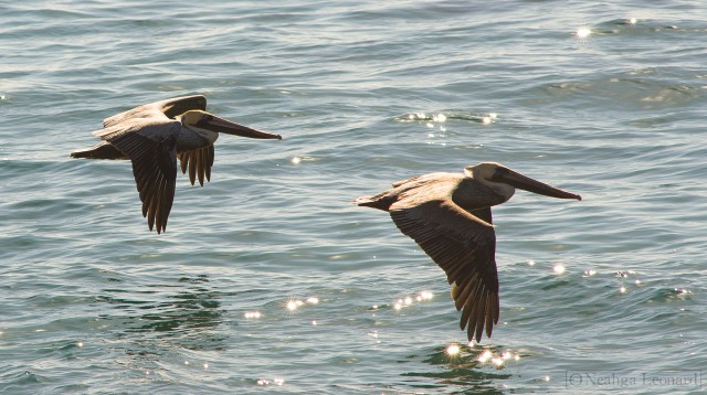
While the dive of a pelican exhibits a singular lack of grace, they are elegant precision flyers. Pelicans of all species are probably best known for their surface skimming flight.

Brown Pelicans skimming the water - the lead pelican does not seem hindered by the loss of an eye

Brown Pelicans skimming the water – the lead pelican does not seem hindered by the loss of an eye

Being large, heavy birds (the largest species of pelicans weigh upwards of 20 pounds), pelicans use as little energy as possible when flying. We see them most often flying low over the water, wings nearly touching the surface of the ocean. The weight of their bodies compresses the air underneath them, making it more dense. As a result the air provides more lift, in effect they are riding on their own cushion of air. We make vehicles that do this, hover craft, and far more impressively, the Soviet ekranoplan vehicles.

Pelicans are adept surfers, riding the slight updraft of air above the curl of breaking waves.

Surfing Pelican

Surfing Pelican

Large air-sacks under the skin and hollow bones help pelicans float and a tough layer of fiber in their breast muscles helps pelicans keep their wings extended during long flights. Like other large birds pelicans search out thermals and other updrafts to climb into the sky for long flights.

I find Brown Pelicans to be surprisingly colorful.

Pelican eying me with suspicion

Pelican eying me with suspicion

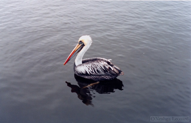
Their heads have yellow, red, and a bluish tint as well. I suspect that the vibrancy of the colors changes in accordance with mating season. Peruvian Pelicans also share this colorful head, perhaps being even more colorful.

Peruvian Pelican (Pelecanus thagus)  in Paracas, Peru

Peruvian Pelican (Pelecanus thagus) in Paracas, Peru

Pelicans have a primeval aspect to them. We no-longer have Pterosaurs, but looking at Pelicans I feel a sense of what it must have been like when the sky was full of those wide-winged, short-tailed flying creatures.

Landing averted

Landing averted

California Bay Laurel – one of the scents of home

The idea of home is a strange one to me.  Moving as often as I have my version of home is more of a set of environmental conditions rather than a living space or a house.  Last week I had an opportunity to pass through the place that feels most like home.

It is a cloudy, damp, foggy portion of land on the northwest coast of California, a place where the land falls sharply into the chilly Pacific and the beaches are as often rocky as sandy.  The hills are steep sided with sensuously rounded tops, sometimes grassy, other times thickly covered in evergreen trees, and much of the region is protected open space.

West Marin, looking at Bolinas and north along the San Andreas fault. Inverness Ridge and Drake’s Bay are visible in the background.

When I was little, West Marin, more specifically the Point Reyes National Seashore, Inverness, Tomales Bay, and Mt. Tamalpais were where I spent much of my time rambling about, climbing trees, playing in shallow cold streams, swimming in the ocean, eating berries, and watching the wildlife.  Whenever I can I return to let the fog play over my skin and to breath the air flavored with the scents of California Bay Laurel (Umbellularia californica), Douglas Fir needles (Pseudotsuga menziesii), and invasive eucalyptus trees.

To the east of the San Andreas fault the land is open, primarily coastal prairie, with the trees safely nestled into the hollows or up against boulders to avoid the strong ocean winds.  The California Bay trees are particularity well adapted to this environment and form dense wind-sculpted stands, looking like glacier scoured boulders.

Low California Bay Laurel (Umbellularia californica) trees sculpted by the ever-present coastal winds

Umbellularia californica trees are tolerant of a variety of conditions and wide spread through California.  They reach into southern Oregon, but, as is true of many plants, California is their epicenter.  In stressful conditions, windy or dry, they only grow to a few feet in height, more of a resilient shrub than a tree.  Where they are protected from the wind and have a good supply of water they reach tremendous proportions, 150 feet or more tall, narrow and slender if competing with redwoods and Douglas fir trees, broad and robust when growing in the open.  Colonies of these trees will sometimes root-graft together, covering a portion of a hill in a single tangled mass of roots and trunks.  The wood decays quickly in the damp and large California bay trees often have multiple hollow trunks, providing homes to numerous animals and giving them a dark and mysterious appearance. The trunks are often covered in dense moss.

Umbellularia californica trunk with a characteristic coat of moss

Umbellularia californica is the only species within its genus and is known by a great variety of common names, Pepperwood, Spicebush, Cinnamon Bush, Peppernut, Oregon Myrtle, Mountain Laurel, Headache Tree, Balm of Heaven, and California Bay to list just a few.  The variety of names reflects its wide range of uses, uses that include medicine, food, insect repellent, timber, and, oddly, currency.  In the early 1930s the bank in the town of North Bend Oregon closed and the local currency collapsed.  The town adopted a currency of coins carved from the wood of this tree.  In North Bend, this currency is still legal tender, though few coins survive to this day.

Leaves, flower buds, and a ripe bay nut

The leaves are rich in pungent oils.  As children we used to put green leaf-covered branches on the fire to watch them flare up as the oil spat and burned.  When dried the leaves are as good for seasoning as the Mediterranean bay laurel, though much stronger and more spicy in flavor.  As with eucalyptus leaves, inhaling the steam from boiled leaves does wonders for stuffy sinuses, and the bay nuts can be roasted and eaten once the fleshy exterior is peeled off.  The fruit looks a bit like the small wild avocado fruits one finds in Central and South America, which makes sense as both the California bay laurel and avocados are in the Laurel (Lauraceae) family.

A dense understory of ferns is common where California bay trees are large

Where the California bay laurels are large and healthy a dense understory of shrubs and ferns is common, California Huckleberry (Vaccinium ovatum) and Western Sword Ferns (Polystichum munitum) are particularly abundant in West Marin.

Western Sword Ferns (Polystichum munitum) growing under a large, multi-trunked California bay laurel

These evergreen ferns grow large, individual fronds often reaching 2.5 to 3 feet in length.  The fronds are waxy and leathery studded long the edges with small teeth and points.  Most people are familiar with these ferns from the moon of Endor in Return of the Jedi, the place the Ewoks live.

Western Shield Ferns look like primordial Christmas Ferns

For those of you in New England the western sword fern will be immediately recognizable as an enormous Christmas fern.  One can easily imagine tough mouthed dinosaurs grazing on these giant ferns.  Today they are rarely eaten by anything except when the fronds are young, or an intrepid insect cuts free a chunk of leaf.

Home is the gentle drip of tangy flavored fog-born moisture dripping from the leaves of the California bay laurels falling onto glistening ferns.  The deeply textured gray of low hanging fog drifting through the forest, the salty bite of cold wind whipping down from the north Pacific, and the constant rustle of animals and water in the underbrush.

One of my homes.

The Frontenac Arch a Critical Linkage

(this is an article I wrote for the summer 2012 newsletter of A2A – Algonquin To Adirondacks Conservation Association – a bi-national conservation association I am an adviser for – I wanted to wait until it was included in the newsletter before posting it here as well)

Between the Algonquin and the St. Lawrence a finger of the Canadian Shield, called the Frontenac Arch, reaches down from the north.  The Canadian Shield is an ancient formation of rock, heavily weathered, marked with meteor craters, and bearing the polishing scars of the ebb and flow of glaciers miles deep. Soils are shallow on the Shield, in many places nonexistent.  Nutrients are hard to come by and wetlands abound.

Red-winged Blackbird (Agelaius phoeniceus)

The bedrock to the east and west of the Frontenac Arch is old seafloor with thicker soils that are rich in minerals and nutrients. Groundwater flows through breaks in the flat bedding planes and does not become trapped in pockets as easily as it does on the Canadian Shield.

When we look at a landscape we often look at the plants growing on the surface and leave our thoughts on the surface with them.  Plants grow where they do because of the chemistry of bedrock, soil, water, and temperature.

On the Frontenac Arch the chemistry of the northern and the southern Canadian forests mix.  This mix shows in the wide and unusual range of plants growing in and around the Frontenac Arch.  The diversity of plants attracts a corresponding diversity in animals. All these plant communities are separated and connected by the dense wetlands, and many animals are drawn to the wetlands.  Frogs, fish, ospreys, turtles, feeding moose, waterfowl of all sorts, beavers, blackbirds, otters, sparrows, loons, and many more.

Male Painted Turtle (Chrysemys picta)

Healthy wetlands are rich in species, both in number and diversity; plant, animal, insect, and bird.  Wetlands are the kidneys of the planet; they filter water and keep it clean.  They slowly recharge aquifers with cool, pure water, they keep rivers and streams clear, they trap sediment, and they eventually fill in, becoming rich, complex soils full of nutrients.

Oddly, perhaps counter intuitively, all this life, more specifically all this diversity, of living things in wetlands is what keeps the water clean.  The water is strained at a molecular level for nutrients by all those living organisms.  Each looks for different things and uses them differently.  Toxins and chemicals are swept up and broken down by this process, but only as long as the diversity of life is present.

When that fabric of diversity is broken the health of the land suffers.  A healthy environment is like good glass, so clear you don’t see it and tough enough to withstand storms.

A large male Snapping Turtle (Chelydra serpentina) and feral biologists

The Frontenac Arch is one of the gems of the region and is critical in connecting the northern and southern forests.

*          *     *     *          *

For those who are interested the Algonquin to Adirondacks Conservation Association website is here, and a map is below:

Algonquin to Adirondacks Conservation Association map of the Frontenac Arch

Loons – the clumsy birds

If you’ve spent time on an undeveloped lake in northern North America or Europe you’ve probably seen or heard loons.  Their calls are loud and eerie, ringing out over still water and carrying far before fading amongst the trees.

Here in Vermont the Common Loons (Gavia immer) have finished nesting, the young have hatched, and the adults are teaching their young how to survive.  Over the past few months they’ve flown in from their winter grounds, found nesting spots, defended them, reproduced, and will stay until the first ice begins to cover the lakes.  The adults carry immature young on their backs.

Kevin T. Karlson photography – common loon with chicks

When the time comes for over-wintering loons fly to the oceans.  In the US there is an excellent loon tracking program that allows you to watch the movements of individual loons over the seasons.

Loons are large waterfowl with a distinct black and white pattern, reminiscent of Penguins, Auks, Razorbills, Puffins, Terns, the questionably named Imperial Shag, and a host of others.  These birds are patterned white on the belly and black on the back for the same reason that Orca and other aquatic predators are; from below the white blends into the sky, and from the above the black blends into the water (or ground), providing camouflage from both prey and predators.

Loons are excellent fliers with long, surprisingly narrow wings

Loons are excellent flyer and fantastic swimmers, but have difficulty on the ground.  Their large bodies are front heavy and they cannot stand upright, as a result they push themselves along the ground, sliding on their bellies. The name Loon derives from Scandinavian names for lame or clumsy, “lúinn” in Icelandic and “lam” in Swedish.

Their inability to walk means that their nests must be close to the water and that the nests must be in well protected places, usually islands or extremely wet peninsulas.  As more and more lake sides are developed there is less and less nesting habitat for loons.  In addition a pair of loons needs 5-20 hectares (12-50 acres) of clear undisturbed water on a lake with many small bays and nooks and a healthy fish population.  Boats and swimmers can easily disturb nesting loons and studies indicate large reductions in nesting success in areas where people come into close contact with nesting loons.

There are few places that meet the nesting requirements and loons are highly territorial during nesting season.

Most of the time loons are heard, not seen, and when seen it is usually from at least a mild distance.  Several weeks ago I came across a freshly dead loon on the shore of a small pond.  Finding dead animals is always interesting as you have an opportunity to look at them up close and discover things you wouldn’t otherwise know.

The background of this particular loon is that it was an undersized male, blind in one eye, that (according to the banding codes) was new to the area.  It fought with the male of an established nesting pair and lost the fight.  A fellow from the Vermont Center for Ecosystem Studies moved the loon to a nearby lake where it stayed for several days, seemingly falling into poorer and poorer health until I found it on the beach.  Upon request I collected the loon so that it could be sent to one of the research labs and an autopsy done on it.

Small male loon found dead

Small male loon found dead

The first thing that caught my eye was the sleek iridescence of the feathers, tending towards a blue-purple on the neck and with an oily sheen on the black back feathers, but it was the legs that fascinated me.  Chicken, duck, and most other familiar birds have round legs.  This makes sense, these birds must support their weight while walking, or waddling in some cases.  Loons don’t walk so their legs don’t need to be especially strong side-to side.  They do need to cut smoothly through the water however, and as such they are blade-like in shape presenting a narrow front to reduce drag.

The white neck feathers stand proud from the black feathers

The white feathers that ring the neck stand proud, rising 2-3mm above a background of short, fine, dense black feathers.  Loons are cold weather birds and, like all water birds, they have dense feathers.  I did not realize just how dense those feathers are though.  Loon feathers feel like rich fur, not feathers, almost felt-like in texture and density.

White speckled back feathers

The white speckles on the loon’s back remind me of an Escher print.

Here in Vermont loons are popular animals and there has been some good work done to protect loon habitat.  As a result, loon breeding success is higher in this state than the national average.  Bans on lead sinkers for fishing have helped the loon population as well as fewer individuals are swallowing the lead and getting poisoned from the metal.

Away Dog! Apocynaceae, the Dogbane family

Near my house, next to the road the ground is sandy with a scattering of pebbles in the mix.  Like much of Vermont what is not bedrock is ground up glacial debris deposited when the vast continental glaciers melted away.  The ground is sandier than most places at my house because I am perched on the southern slope of a small rock outcrop, a place where the downward pressure of the glacier was lighter, water flowed under the ice, and fine sediment was deposited.

In that sandy ground there are wild strawberries, mosses, dandelions, fleabane, hay scented ferns, a few coneflowers, some potentillas, Allegheny blackberry, a little bracken fern, and a small stand of dogbane (Apocynum cannabinum) with delicate pink flowers.

Hemp Dogbane (Apocynum cannabinum)

Before moving to Vermont my only experience with this plant was via books.  I always wondered why it was called Dogbane.  Was it like negative catnip for dogs?  Or was it simply toxic to dogs?  Apparently it is a toxin, and not just to dogs.  Ingestion of any portion can induce cardiac arrest and both the family and genus name literally translate to, “Away Dog!”  Apocynum cannabinum has, thick, milky sap, much like a milkweed, indeed Milkweeds (Asclepiadoideae) are now considered to be a subfamily of the Dogbanes (Apocynaceae).  Other members of the Dogbane family include two of my least favorite plants, Oleander and Vinca, both from the Mediterranean and common in California where they were introduced as ornamentals.  Oleander can be seen in any urban environment in Southern California, most often as a highway divider plant.  The sap is extremely toxic, raising painful rashes, and the smoke can be lethal if inhaled.  Vinca, more commonly known as periwinkle, is  common in Northern California where it invades riparian areas, covering both ground and small trees in a dense, vining mat of glossy green leaves studded with pretty blue flowers.  It is nearly impossibly to eradicate once in place.

In the past some Apocynaceae species were used to make a poor quality rubber, others for toxin to apply to arrows.  Some species produce edible fruit and others edible flowers.  We extract heart drugs from a few of them as well.

The dogbane in my yard, Apocynum cannabinum, is a traditional North American source for extremely strong fiber, hence the “cannabinum ” species name, referring to the hemp-like characteristic of the plant.  Common names run from simply Dogbane, to Indian Hemp, Wild Cotton, and Hemp Dogbane.  The fibers are stripped from the stalk in late fall and can be twisted into a fine, strong cord.  Cords made from dogbane were prized for their great strength and used for sewing, fishing lines, and other work requiring fine cordage.

The Hemp Dogbane ranges from calf high to chest high.  The ones in my yard top out at waist high.  The have an odd branching structure, perhaps best described as irregular opposite.  The main stalk continually divides in a binary fashion, with one side acting as a dominate leader, this pattern is often repeated on the side branches, but in some cases buds on both side of the stem will form side branches instead.  The result is a roughly Y shaped plant that rapidly spreads as it grows.

Apocynum cannabinum whole plant.

The leaves are opposite and the undersides are covered with a fine pubescence.  I expect that the hairy leaves are an adaptation to help cope with moisture stress.  Plants often evolve this trait to create a boundary layer of trapped, still air that aids in preventing moisture from being blown away.  The upper leaf surfaces have a matte waxy texture, a little like nasturtium leaves.  Water beads and runs off of them rapidly.

Apocynum cannabinum leaf hairs

The seeds are held in long, horn-like pods.  This time of year few of the seed pods have developed, but a couple of plants are a little further along in the cycle than others.

Apocynum cannabinum seed pods, not fully developed

Few of the leaves have any insect damage, but the flowers are popular with a number of insect species.  I’ve seen ants, flies, bees, and moths going to them.  Hidden amongst the flowers are predators as well.  The Goldenrod Crab Spider (Misumena vatia) seems fond of my dogbane.

Goldenrod Crab Spider (Misumena vatia) playing parlor games with a fly

Goldenrod Crab Spiders are so called because they often hide amongst the bright yellow flowers of goldenrod, a common meadow plant in New England.  The spiders change color from white to yellow and back again based on input from their eyes.  The yellow color seeps up to stain their carapace, providing camouflage.  When they move to a pale flower the production of this pigment stops and the spiders slowly turn white once more.  Experiments show that the spider will not change color if it cannot see what color plant it is on.

These are not web building spiders, they are ambush hunters, grabbing unsuspecting prey in their wide arms.

The smell of the flowers is odd and difficult to describe, incorporating many scents including a dusty sweetness and a faint rankness like dried meat on the edge of going bad, but they are pretty.

Balsas on the Rio Alto Madidi in Bolivia

I have wanderlust.  Intense wanderlust; the kind of wanderlust that makes your teeth hurt, your hands itch, and your mind always turn to the new, the unknown.

I don’t often get to indulge in my wanderlust, so when I do I try to make it count.  Back in 2005 I quit the very nice job I had as the cellar-master of a lovely little California winery and left for South America, all in all spending about a year working on various ecology related projects and traveling.  It was amazing and, despite the troubles that emerged from it, eminently worth the experience for far too many reasons to enumerate.

One of the key drivers of my wanderlust is the desire to learn new things and encounter new challenges, and in Bolivia I got to learn some extremely interesting things about a plant I only knew a little about before.

Balsa (Ochroma pyramidale).  We in the northern hemisphere know it mainly from toy airplanes, model making, and sometimes from lightweight packing crates.  I suspect that a number of people reading this blog will have read about Thor Heyerdahl’s incredible 1947 Kon Tiki expedition where he and 5 companions spent 101 days traveling 4300 miles across the Pacific on a raft made from Balsa logs based on ancient Peruvian raft designs.  If you have not read this book, go out and get it immediately, also look for the movie he made while on the raft which is also incredible.  I digress, the point being that most of us know Balsa as a lightweight wood used for novelty items.

In South America it is used for far more than novelty items.  River rafts being key amongst the numerous uses of this amazing plant.

Our supply raft, Rafael and Franklin piloting it down the Río Madidi

Balsa is a short-lived, small to midsized tree that grows rapidly, reaching not much more than 90 feet tall in 10-15 years and dying within 50 years.  Balsa is in the Malvaceae family, a group of  intensely useful plants that included cocoa, hibiscus, durian, jute, okra, bass wood, and a number of ornamental plants.  In the Amazonian lowlands, where the rivers often over-run their banks Balsa trees often line the rivers in thicket-like stands along with Caña Brava (Gynerium sagittatum), a tall reed that looks like a fan-topped cross of Arundo donax and bamboo.

Balsa Colorado (red balsa) and Caña Brava lining a riverbank

The seeds develop in rugby ball shaped pods that break open to reveal thousands of tiny fluffy seeds that trickle out and drift away on the wind, or drop on the water to float down river.  They come to rest in the sticky mud of the river banks, then sprout and grow rapidly, trying to reproduce before the next flood that scours the landscape clean.

Balsa seeds are light, drifting on the wind and floating on the water

My first introduction to the diversity of uses Balsa can be put to was when I embarked on a 20 day trip into the Madidi National Park in northern Bolivia at the eastern foothills of the Andes.  To go in as deeply as I and my 2 traveling companions wanted to involved a guide, 3 porters/navigators, and a 2 day motorboat ride up the Río Tuichi where we were dropped off on the river bank followed by the boat turning and leaving us.

Welcome to the jungle – yes, that is an enormous catfish on the rock next to the river, caught with a machete

Our local guides and porters did not have backpacks, only synthetic canvass sacks filled with food and cooking gear, lacking shoulder straps.  The first 4 or so days of our trip involved long hikes, clearly there needed to be a better way of carrying these sacks than slung over one’s shoulder like Santa Claus.  Near where we were dropped off were some young Balsa trees, about the diameter of a broomstick, maybe larger.  The bark was peeled off and stripped down to the cambium layer, resulting in a long, translucent ribbon of surprisingly tough fiber which was, with the addition of several pebbles, swiftly put into use as shoulder straps for the carry bags.  This material was so tough that it did not need to be replaced for the extent of the trip.

After quite a bit of hiking, some interesting encounters, and a few adrenaline filled moments we crossed over a line of low mountains and followed the stream down the other side to a point where we could no-longer wade across.  We were on the Alto Río Madidi and we needed boats to continue.  There were trees and we had machetes.

Tío (we all called him “uncle”) peeling bark from a Balsa tree

We camped for several days felling 15 or so young Balsa trees with trunks about the diameter of your thigh, cut some short acacia rods, some Caña Brava, and made rope from the cambium of sapling Balsa trees.  When we were done we had two fine river craft, one for two people and everyone’s luggage, another for myself, my two traveling companions, our guide, and one of the porter/navigators.

Two rafts made with machetes from Balsa logs. A mooring rope of Balsa cambium is coiled on the foremost raft

For the remaining 16 days of our trip these rafts served us well, riding through flash floods, over rapids, banging into submerged logs and steep banks, with minimal problems, keeping us dry and stable the whole time.  When they needed repairs all we had to do was collect material from the riparian vegetation and we were back in business.

Balsa leaves are large and soft.  Many insects eat the leaves as there is little, if any, toxin in them, the tree spending its energy on growth rather than protection.  I have seen entire trees completely denuded of leaves within a day by leaf cutter ants.  We used the leaves as well.  The make adequate toilet paper (the lack of toxin being especially important in that instance), for cooking, and for carrying food.  We cut bamboo, filled the culms with freshly caught fish, packed Balsa leaves in the open top to prevent steam from escaping and placed the fish packed bamboo next to the fire to cook.  We carried lunches of roasted fish cooked the night before wrapped in Balsa leaves, and would pick them to use as seat covers on muddy ground.

Lunch carried wrapped up in Balsa leaves

The word balsa, means raft and the ones we made were proof that the tree is well named.

Me running rapids on the Alto Madidi with Tío in front and our guide, Pedro MasCuapa in the rear

A side note, the area we went into is sparsely traveled; the year I went in our group was the only one that had gone so far in and only 3 or 4 other groups had gone into the park more than a day’s hike that year.  If tourism were to increase in the area, a different raft solution would have to be sought.

These photos were taken with a Canon AE-1 with a 50mm 1.8 lens.  All the film was developed and scanned in South America and the picture quality reflects the abuse I put the camera through and the questionable film developing of the places I went to.

The final photo of me was taken by one of my traveling companions.

The Mighty Dragonfly

Of all insects there are few that capture our attention and interest the way dragonflies do.  They have, perhaps, the coolest, most evocative name of any group of insects: Dragonfly.  In English there are a great number of other common categorical names: Devil’s Darning Needle, Snake Doctor, and Ear Cutter among others.  Many of these names come from the mystifying apparent fear of nature that crops up over and over in European views of the world.  Many European cultures viewed dragonflies as sinister creatures, servants of the devil, in league with other evils such as snakes and bats.

Other cultures, often more agrarian ones, had a far more benign view of dragonflies, based, perhaps, on the recognition of their fundamental role in controlling populations of pest insects of all sorts.  An archaic name for the Japanese Islands is Akitsushima (秋津島), the Dragonfly Islands, where dragonflies symbolized courage, strength, and happiness.  For some native American tribes dragonflies symbolized clean, pure water, swiftness, and agility.  In the modern world dragonflies are good indicators of environmental heath, indicating a robustly functioning ecosystem.

Libellula quadrimaculata – Four Spotted Skimmer
The Alaskan State Insect

Dragonflies and their close relatives, Damselflies, come in a dazzling array of colors and patterns, ranging in size from less than  an inch long up to the South American Megaloprepus caerulatus with a wingspan of over 7 inches.  The largest dragonfly we know of is from the 300 million year old fossil Meganeura that had a wingspan of over 2 feet.

Dragonflies are powerful hunters, both in their nymph and adult stages.  Dragonfly nymphs are aquatic and prey on any animal or insect they can grab with their claws or their extendible jaws.  Insects, small fish, tadpoles, and small amphibians are all food for these voracious predators.  The nymphs are large, and, in turn, are prey for a wide range of other animals, insects, birds, and fish.  Elva Paulson has some wonderful watercolors of a dragonfly emerging from its nymph stage.  Humans are included as predators, many Asian cultures eating both dragonfly nymphs and adult dragonflies as delicacies.  One of the most tasty things I’ve eaten (from a long list of foods most people would consider to be unusual) was a plate of deep fried dragonfly larvae.  Absolutely delicious.  In Beijing I would sometimes find adult dragonflies candied in liquid sugar, their wings crispy with the hardened sugar.

Unknown green dragonfly – note the barbs on the forelegs for catching prey

The adult phase of a dragonfly’s life is short, in temperate climates only the length of the summer.  This is their mating stage and it takes them between 2 months and 6 years living under water to reach this stage.  Dragonflies are extremely active during this mating phase and must eat often.  They have enormous eyes giving nearly 360 vision, incredibly swift reactions, fast, powerful flight, and wicked barbs on their legs to assist capturing insects in flight.  The inset above shows these barbs.

Libellula exusta – White Corporal (I think)
eating its prey

The common names of dragonflies often reflect their speed or their abilities as hunters.  Meadow-hawk is one of my favorite names, and watching one dart away to catch an insect and return to its roost to devour it definitely brings hawks to mind.

Libellula quadrimaculata – Four Spotted Skimmer
note the different wing heights

Dragonflies are powerful fliers.  They have been clocked at over 35 miles an hour, fast enough to get a speeding ticket in a school zone, and, like hummingbirds, can fly forwards, backwards, sideways, up and down, and hover.  Their backs are sloped where their wings anchor, placing each pair at different heights, allowing for tremendous wing mobility.  Some species of dragonfly migrate, but the scale of some of those migrations has only recently been realized.  One dragonfly species in particular, the Globe Skimmer (Pantala flavescens) flies from India to Africa and back, island hopping cross the Indian Ocean, making open water crossings of nearly 1000km (620 miles) between island stops.  The only places they can breed are at the Indian and African ends of the migration, many of the islands they use as stopover points do not have sufficient freshwater for dragonflies to breed.  This is a stunning feat of flying for an insect and may be a behavior that evolved as a result of plate tectonics splitting India and Africa apart, eventually thrusting India into Asia.  If so, this migration could have begun 135 millions years ago.  Unfortunately, we have no reliable way of telling if this is the case.

Last year was a good year for dragonflies in Vermont, and this year looks like it is shaping up to be a good one as well.  The ecologist in me cannot help wondering why and one idea is that it may be linked to the calamitous drop in bat populations as a result of white-nose disease, a fungus that infects hibernating bats, weakening and eventually killing them.  It may be that adult dragonflies have more to eat with fewer bats and a greater percentage of them are surviving through the summer.  There is a historical precedent for this sort of boom in insect populations.  During the Great Leap Forward, Chairman Mao promoted a policy of killing off all things he thought were eating grain, birds amongst these.  With the crash in bird populations in China the insect population exploded.

Unidentified dragonfly – maybe a Darner of some sort

I am happy to see the dragonflies here.  Their presence means that the water is clean, we will have fewer mosquitoes, midges, and black-flies, and they are extraordinarily beautiful creatures.

Three-hundred twenty-five millions years old and going strong.  They have it figured out!